
Maps
Ask us how


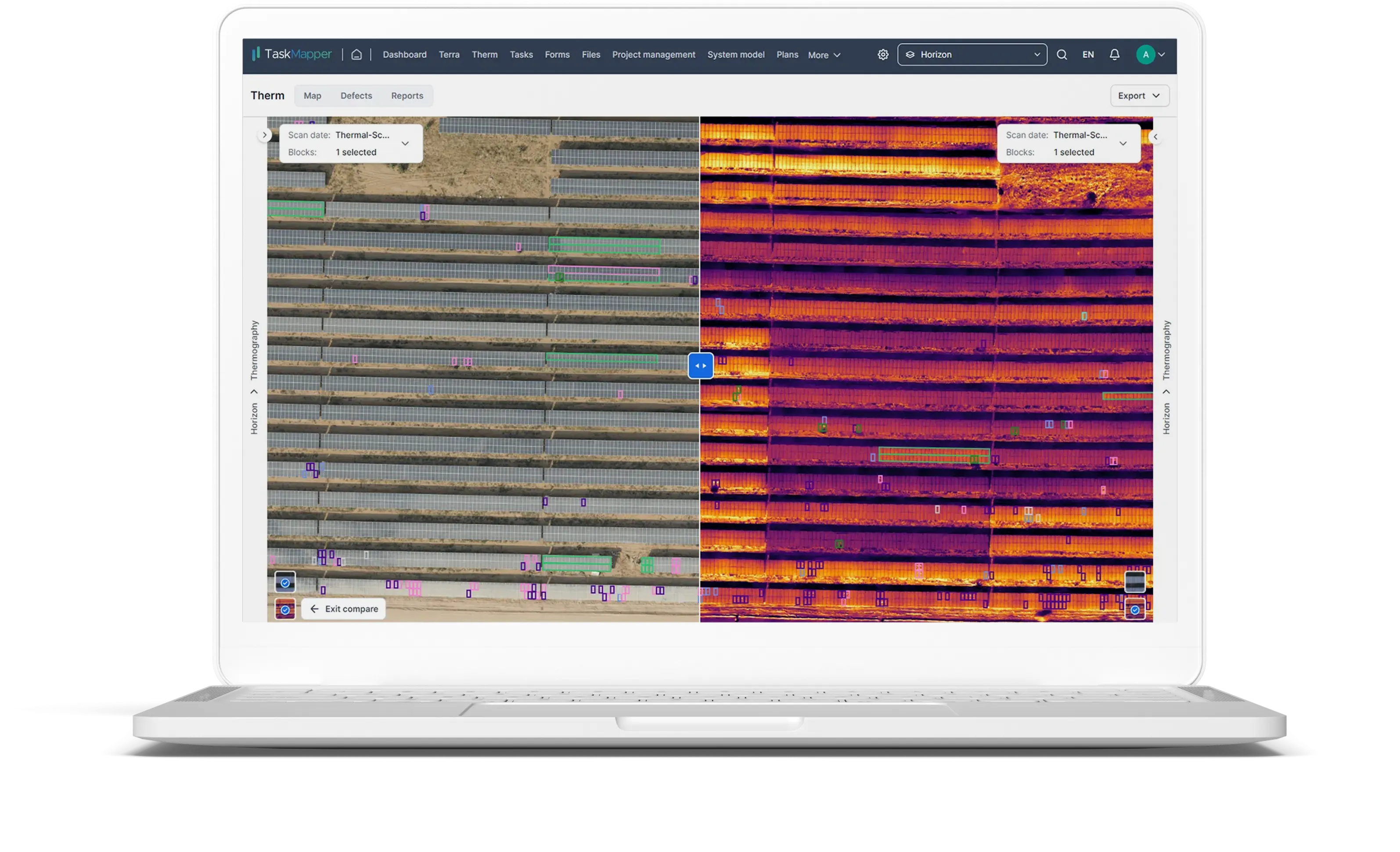
View your site data on a map
Import your site data and design files. View them as layers on the map. Improve planning and simplify onsite work with access to all data on a map.

Easily navigate to assigned tasks
Speed up maintenance tasks and defect handling with tasks-on-a-map. Access related checklists, forms, and files. Share updates and add photos and observations.

Track construction progress
Visualize and track installation progress on a map. Track progress, view updates, and compare progress against your plan.

Collaborate better with shared views
Use insights to identify potential risks early. Track impacts and costs to assess potential risks. Mitigate the risks proactively.
Get location-specific jobsite views & data. Access data from surveys, land studies, plans, and more on a map.

Track real-time project status on a map
Simplify project tracking with everything on a map. Import, view, and manage files, tasks, forms, and annotations on a shared map view. Track progress and as-builts. Manage onsite work.
Track your project and view progress updates on a map.
Track activities, materials, equipment, and crews with location as context.
See your data and reports on a map. Identify issues and opportunities.
Optimize planning and construction
Import GIS data and site layouts to visualize the data. Centralize and manage development, planning, and construction workflows on a map.
Plan effectively. Assess project designs with layered map views integrating site design options and terrain data.
Track your resources and equipment onsite to optimize usage.
Monitor as-built against the plan to identify and address potential delays.

Communicate effectively with stakeholders
Manage onsite work on a map. Easily access information, files, and records for each component digital twin. Seamlessly connect data and teams with shared views and common goals.
Reduce site visits with real-time reporting through digital site maps.
Connect office and site teams with map-based tasks, forms, and files.
Communicate effectively with stakeholders. Use map-based visualizations and reports.