
KNOW
KNOW
KNOW
KNOW is a modern, custom-built, mobile accessible GIS for all your topography and site planning needs. It integrates raster and vector layers from ALTA + drone surveys, hydrology studies, land use + ecology maps and CAD, layers it over Google or Mapbox base maps in an input-agnostic interface. This enables location-specific views that reduce plan times and support construction.
KNOW is a modern, custom-built, mobile accessible GIS for all your topography and site planning needs. It integrates raster and vector layers from ALTA + drone surveys, hydrology studies, land use + ecology maps and CAD, layers it over Google or Mapbox base maps in an input-agnostic interface. This enables location-specific views that reduce plan times and support construction.
KNOW is a modern, custom-built, mobile accessible GIS for all your topography and site planning needs. It integrates raster and vector layers from ALTA + drone surveys, hydrology studies, land use + ecology maps and CAD, layers it over Google or Mapbox base maps in an input-agnostic interface. This enables location-specific views that reduce plan times and support construction.


Complete desktop land studies for site evaluation
Evaluate energy potential, see interconnection points, and leverage land use data for planning and approvals for your site.

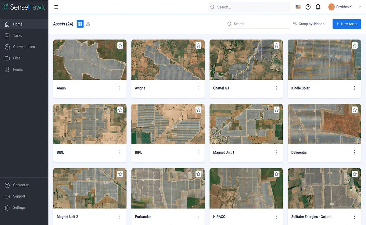
Access all your GIS and CAD data in one place
From pre-construction infrastructure planning to SWPPP and permitting, access the data and insights you need for site planning in one interface.
Complete desktop land studies for site evaluation
Evaluate energy potential, see interconnection points, and leverage land use data for planning and approvals for your site.
Access all your GIS and CAD data in one place
From pre-construction infrastructure planning to SWPPP and permitting, access the data and insights you need for site planning in one interface.

Actionable insights for planning your site
Actionable insights for planning your site
Actionable insights for planning your site
KNOW is a mobile accessible GIS for all your site planning needs.
It integrates multi-source information and layers it over Google or Mapbox base maps in an input-agnostic interface to enable location-specific views that reduce plan times and support construction.
KNOW is a mobile accessible GIS for all your site planning needs.
It integrates multi-source information and layers it over Google or Mapbox base maps in an input-agnostic interface to enable location-specific views that reduce plan times and support construction.
KNOW is a mobile accessible GIS for all your site planning needs.
It integrates multi-source information and layers it over Google or Mapbox base maps in an input-agnostic interface to enable location-specific views that reduce plan times and support construction.
We believe the SenseHawk digital workflow solution for our operating sites will result in substantial productivity gains for our O&M team. It is the type of innovation essential for scaling renewables.
Abhijit Sathe
Co-CEO, SB Energy, USA

Our experience with SenseHawk during 2020-21 has been great. The SenseHawk team is very customer oriented, always focused on delivering data acquisition and analytics solutions despite constraints posed by the pandemic situation.
Jorge Garrido
Head O&M, FRV

Our experience with SenseHawk during 2020-21 has been great. The SenseHawk team is very customer oriented, always focused on delivering data acquisition and analytics solutions despite constraints posed by the pandemic situation.
Jorge Garrido
Head O&M, FRV
We believe the SenseHawk digital workflow solution for our operating sites will result in substantial productivity gains for our O&M team. It is the type of innovation essential for scaling renewables.
Abhijit Sathe
CEO
Location-specific views & data on in-built GIS that integrates layered inputs from SRTM, ALTA, & other surveys.
Location-specific views & data on in-built GIS that integrates layered inputs from SRTM, ALTA, & other surveys.
Location-specific views & data on in-built GIS that integrates layered inputs from SRTM, ALTA, & other surveys.
Organize terrain data
Organize terrain data
Organize terrain data
Access terrain information and sensor-driven topography reports to help you study the energy potential, land use data, and interconnection points for your site.
Access terrain information and sensor-driven topography reports to help you study the energy potential, land use data, and interconnection points for your site.
Access terrain information and sensor-driven topography reports to help you study the energy potential, land use data, and interconnection points for your site.
Integrate views across existing data silos to inform work from planning to construction and operations.
Integrate views across existing data silos to inform work from planning to construction and operations.
Integrate views across existing data silos to inform work from planning to construction and operations.
Optimize procurement of inventory during construction.
Optimize procurement of inventory during construction.
Optimize procurement of inventory during construction.


Upload your designs
Upload your designs
Upload your designs
Upload your CAD drawings or as-built designs and view them on the map interface with associated component details from the AIM.
Upload your CAD drawings or as-built designs and view them on the map interface with associated component details from the AIM.
Upload your CAD drawings or as-built designs and view them on the map interface with associated component details from the AIM.
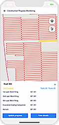
Easily monitor and resolve deviations from design specifications from the same screen with tasks and forms.
Easily monitor and resolve deviations from design specifications from the same screen with tasks and forms.
Easily monitor and resolve deviations from design specifications from the same screen with tasks and forms.
Centralize access for your teams
Centralize access for your teams
Centralize access for your teams
Control your teams’ access to all your site related information, eliminate data silos, and realize cost efficiencies.
Control your teams’ access to all your site related information, eliminate data silos, and realize cost efficiencies.
Control your teams’ access to all your site related information, eliminate data silos, and realize cost efficiencies.
Get version controlled views of all files including contracts and warranties.
Get version controlled views of all files including contracts and warranties.
Get version controlled views of all files including contracts and warranties.


KNOW in time, everytime
Solar-power developer needs a solution to protect against damage of its expensive automated cleaning system.
Rethinking onsite operations
with insights from KNOW for a
leading energy company.
Read more
KNOW in time, everytime
Solar-power developer needs a solution to protect against damage of its expensive automated cleaning system.
Rethinking onsite operations with insights from KNOW for a leading energy company.
Read more
KNOW in time, everytime
Solar-power developer needs a solution to protect against damage of its expensive automated cleaning system.
Rethinking onsite operations with insights from KNOW for a leading energy company.
Read more
Get access to everything you need to get the job done NOW
Ask us how
Get access to everything you need to get the job done NOW
Ask us how
Get access to everything you need to get the job done NOW
Ask us how
TaskMapper Solar
Products
TaskMapper Solar
Products
TaskMapper Solar